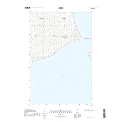
2019 Map of Manomin Creek SE
USGS Topo · Published 2019About this map
Lower Red Lake dominates this northern Minnesota landscape, where the vast open waters of the lake meet the forested shorelines of Beltrami County. This 2019 survey captures a sparsely populated region defined by its hydrography and reservation lands. The transition between Upper Red Lake and its lower counterpart is a central feature, reflecting the essential role these massive water bodies play in the local ecosystem and culture. Transport through the area is primarily facilitated by Resvn Hwy 27, which follows the northern shoreline of the lower lake. The map documentation includes precise public land survey system boundaries, such as those for t154n r35w and t153n r34w, providing clear markers for property and jurisdictional research within this expansive aquatic and woodland environment.
Find a feature on this map
7 named features on this map. Tap any name to fly to it.
Don’t see what you’re looking for? This feature index may not catch every label — zoom into the map to look around manually.
Map Details
Editions of this 2019 Manomin Creek SE Map
This is the sole edition of this map. No revisions or reprints were ever made.
Other maps of this area

1919 · Ponemah
USGS Topo · 1:62,500

1943 · Ponemah
USGS Topo · 1:62,500

1954 · Bemidji
USGS Topo · 1:250,000

1954 · Roseau
USGS Topo · 1:250,000

1957 · Roseau
USGS Topo · 1:250,000

1957 · Bemidji
USGS Topo · 1:250,000

1958 · Bemidji
USGS Topo · 1:250,000

1958 · Roseau
USGS Topo · 1:250,000

1973 · Manomin Creek SE
USGS Topo · 1:24,000

1973 · Mosquito Creek
USGS Topo · 1:24,000