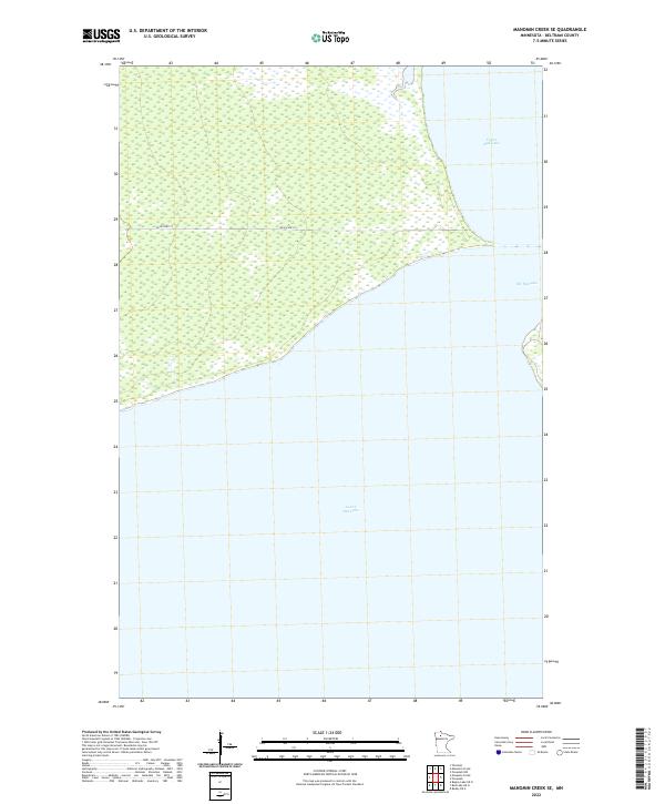
2022 Map of Manomin Creek SE
USGS Topo · Published 2022About this map
Upper Red Lake and Lower Red Lake dominate this northern Minnesota landscape, where the two massive bodies of water nearly meet. The passage known as The Narrows connects these basins, creating a unique hydrological bottleneck in Beltrami County. This area is characterized by expansive wetlands and marshy shorelines that separate the open waters from the surrounding forest and prairie systems. The presence of Resvn Hwy 27 provides a solitary arterial route through the wetlands, tracing the northern edge of the lower lake. The map reveals the immense scale of the Red Lake system, focusing on the aquatic transition zone rather than dense settlement, offering researchers a clear view of the natural shoreline and the primary transportation corridor used to navigate the reservation lands.
Find a feature on this map
10 named features on this map. Tap any name to fly to it.
Don’t see what you’re looking for? This feature index may not catch every label — zoom into the map to look around manually.
Map Details
Editions of this 2022 Manomin Creek SE Map
This is the sole edition of this map. No revisions or reprints were ever made.
Other maps of this area

1919 · Ponemah
USGS Topo · 1:62,500

1943 · Ponemah
USGS Topo · 1:62,500

1954 · Bemidji
USGS Topo · 1:250,000

1954 · Roseau
USGS Topo · 1:250,000

1957 · Roseau
USGS Topo · 1:250,000

1957 · Bemidji
USGS Topo · 1:250,000

1958 · Bemidji
USGS Topo · 1:250,000

1958 · Roseau
USGS Topo · 1:250,000

1973 · Manomin Creek SE
USGS Topo · 1:24,000

1973 · Mosquito Creek
USGS Topo · 1:24,000