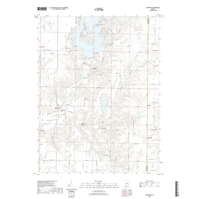
2019 Map of Mansfield
USGS Topo · Published 2019About this map
Mansfield Bridge and the Rocky Fork Covered Bridge anchor the historic character of this landscape along the border of Parke and Putnam counties. The area is defined by the winding course of Big Raccoon Creek and the expansive waters of Cecil M Harden Lake, which dominates the northern portion of the quadrangle. Small settlements like Mansfield, Ferndale, and Keytsville serve as local hubs for the surrounding agricultural and timbered lands. For those tracing family histories, numerous small burial grounds are preserved across the terrain, including Roach Cem, Britton Cem, and Martin Cem. The intricate network of rural roads, such as Ferndale Rd and New Discovery Rd, connects these isolated communities and follows the natural drainages of Rocky Fork Cr and Little Rocky Fork Cr.
Find a feature on this map
116 named features on this map. Tap any name to fly to it.
Don’t see what you’re looking for? This feature index may not catch every label — zoom into the map to look around manually.
Map Details
Editions of this 2019 Mansfield Map
This is the sole edition of this map. No revisions or reprints were ever made.
Other maps of this area

1950 · Brazil East
USGS Topo · 1:24,000

1950 · Brazil West
USGS Topo · 1:24,000

1951 · Clinton Falls
USGS Topo · 1:24,000

1951 · Mansfield
USGS Topo · 1:24,000

1952 · Catlin
USGS Topo · 1:24,000

1952 · Reelsville
USGS Topo · 1:24,000

1953 · Indianapolis
USGS Topo · 1:250,000

1955 · Rockville
USGS Topo · 1:24,000

1955 · Russellville
USGS Topo · 1:24,000

1956 · Indianapolis
USGS Topo · 1:250,000