
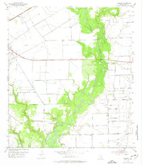
1952 Map of Manson
USGS Topo · Published 1953About this map
The Navidad River and Lavaca River converge in this mid-century survey of Jackson County, carving a complex riparian landscape through the Texas coastal prairie. The settlement of Manson sits along the Southern Pacific tracks in the northwest, serving as a railroad point in an area increasingly defined by industrial expansion. The presence of the Texana Oil Field and numerous scattered Oil Wells indicate the era's energy boom, while an extensive network of Levees and a Spoil Bank reveal significant efforts to manage the low-lying terrain and river drainage.
Find a feature on this map
21 named features on this map. Tap any name to fly to it.
Don’t see what you’re looking for? This feature index may not catch every label — zoom into the map to look around manually.
Map Details
Editions of this 1952 Manson Map
Other maps of this area

1952 · Francitas NW
USGS Topo · 1:24,000

1952 · Edna
USGS Topo · 1:24,000

1952 · La Salle
USGS Topo · 1:24,000

1952 · La Ward
USGS Topo · 1:24,000

1952 · Lolita
USGS Topo · 1:24,000

1953 · Beeville
USGS Topo · 1:250,000

1953 · Seguin
USGS Topo · 1:250,000

1956 · Beeville
USGS Topo · 1:250,000

1958 · Seguin
USGS Topo · 1:250,000

1960 · Beeville
USGS Topo · 1:250,000