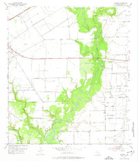
1952 Map of Manson
USGS Topo · Published 1974About this map
The Navidad River and Lavaca River converge in this mid-century portrait of Jackson County, where the landscape is defined by the heavy infrastructure of the Texana Oil Field. The survey captures a moment when the regional economy was deeply tied to energy extraction, evidenced by an extensive network of pipelines and levees crossing the river bottoms. Near the confluence, the Historical Monument stands as a marker of the area's pioneer heritage, located just south of the Brackenridge Cem.
Find a feature on this map
14 named features on this map. Tap any name to fly to it.
Don’t see what you’re looking for? This feature index may not catch every label — zoom into the map to look around manually.
Map Details
Editions of this 1952 Manson Map
Other maps of this area

1952 · Francitas NW
USGS Topo · 1:24,000

1952 · Manson
USGS Topo · 1:24,000

1952 · Edna
USGS Topo · 1:24,000

1952 · La Salle
USGS Topo · 1:24,000

1952 · La Ward
USGS Topo · 1:24,000

1952 · Lolita
USGS Topo · 1:24,000

1953 · Beeville
USGS Topo · 1:250,000

1953 · Seguin
USGS Topo · 1:250,000

1956 · Beeville
USGS Topo · 1:250,000

1958 · Seguin
USGS Topo · 1:250,000