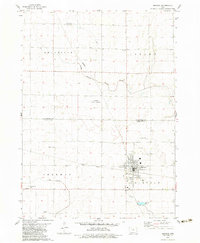
1979 Map of Manson
USGS Topo · Published 1983About this map
The town of Manson serves as the primary hub in this late 1970s survey of the Pocahontas and Calhoun County line. The landscape is defined by its agricultural layout, featuring an extensive network of drainage infrastructure including Ditch No 47 and Ditch No 9 & 13 feeding into South Branch Lizard Creek and East Cedar Creek. A notable conservation area, the Kalsow State Prairie, preserves a segment of the original prairie landscape amidst the surrounding farmland. Transportation is anchored by the Illinois Central Gulf railroad passing through the southern half of the quadrangle. For genealogists, the map is remarkably detailed, marking several burial sites such as Swedish Cem, Rose Hill Cem, and St Paul Cem, along with the Sherman School and a small Landing Strip north of the main settlement.
Find a feature on this map
25 named features on this map. Tap any name to fly to it.
Don’t see what you’re looking for? This feature index may not catch every label — zoom into the map to look around manually.
Map Details
Editions of this 1979 Manson Map
2 editions found
Other maps of this area

1954 · Fort Dodge
USGS Topo · 1:250,000

1957 · Fort Dodge
USGS Topo · 1:250,000

1958 · Fort Dodge
USGS Topo · 1:250,000

1965 · Knierim
USGS Topo · 1:24,000

1979 · Pocahontas
USGS Topo · 1:24,000

1979 · Gilmore City SW
USGS Topo · 1:24,000

1979 · Manson
USGS Topo · 1:24,000

1979 · Pomeroy
USGS Topo · 1:24,000

1979 · Gilmore City
USGS Topo · 1:24,000

1979 · Palmer
USGS Topo · 1:24,000