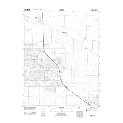
2012 Map of Manteca
USGS Topo · Published 2012About this map
Manteca and its surrounding agricultural corridors are mapped here during a period of significant suburban expansion in San Joaquin County. The landscape is defined by a dense grid of local roads and the prominent thoroughfares of Highway 99 and Highway 120, which intersect near Calla. Residential neighborhoods radiate outward from the central city, yet the map retains evidence of the area's rural character through large plots such as the Ripon Poultry Farm and the winding course of Lone Tree Cr to the north and east. Local history and genealogy interest is anchored by the Union Memorial Cem near the city center and Park View Cem near Manteca Junction. Smaller named locales like Summer Home, Bardi, and Five Corners serve as markers for the historic intersections and rail sidings that helped develop this part of the Central Valley.
Find a feature on this map
161 named features on this map. Tap any name to fly to it.
Don’t see what you’re looking for? This feature index may not catch every label — zoom into the map to look around manually.
Map Details
Editions of this 2012 Manteca Map
This is the sole edition of this map. No revisions or reprints were ever made.
Other maps of this area

1913 · Stockton
USGS Topo · 1:31,680

1914 · Burnham
USGS Topo · 1:31,680

1914 · Manteca
USGS Topo · 1:31,680

1914 · Avena
USGS Topo · 1:31,680

1915 · Vernalis
USGS Topo · 1:31,680

1915 · Lathrop
USGS Topo · 1:31,680

1915 · Ripon
USGS Topo · 1:31,680

1915 · Peters
USGS Topo · 1:31,680

1915 · Salida
USGS Topo · 1:31,680

1922 · Carbona
USGS Topo · 1:62,500