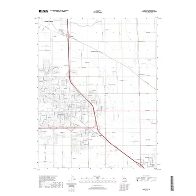
2018 Map of Manteca
USGS Topo · Published 2018About this map
The agricultural heart of San Joaquin County is on full display in this 2018 survey, centered on the growing city of Manteca and its surrounding communities. The landscape is defined by a dense grid of rural roads and irrigation channels that support the Central Valley's productivity, with Lone Tree Cr winding through the northern sections. This edition captures the city's modern residential expansion, yet it preserves the locations of several long-standing local landmarks. Genealogists will find the Park View Cem near Manteca Junction and the Union Memorial Cem to be valuable points of reference. Smaller named locales such as Summer Home, Calla, and Five Corners reveal the persistent identity of historic crossroads even as industrial and commercial corridors develop along the major thoroughfares. The southern edge of the map features the outskirts of Ripon, marking the transition toward the Stanislaus River corridor.
Find a feature on this map
39 named features on this map. Tap any name to fly to it.
Don’t see what you’re looking for? This feature index may not catch every label — zoom into the map to look around manually.
Map Details
Editions of this 2018 Manteca Map
This is the sole edition of this map. No revisions or reprints were ever made.
Other maps of this area

1913 · Stockton
USGS Topo · 1:31,680

1914 · Burnham
USGS Topo · 1:31,680

1914 · Manteca
USGS Topo · 1:31,680

1914 · Avena
USGS Topo · 1:31,680

1915 · Vernalis
USGS Topo · 1:31,680

1915 · Lathrop
USGS Topo · 1:31,680

1915 · Ripon
USGS Topo · 1:31,680

1915 · Peters
USGS Topo · 1:31,680

1915 · Salida
USGS Topo · 1:31,680

1922 · Carbona
USGS Topo · 1:62,500