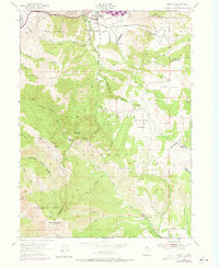
1955 Map of Mantua
USGS Topo · Published 1973About this map
Mantua sits at the heart of this mid-century survey, positioned within a high mountain valley between the Wellsville Mts and the steep slopes leading to Willard Mtn. The town’s rural character is underscored by the Cem and Picnic Grounds along Box Elder Creek, which flows through Wellsville Canyon. High-altitude land use is evident in the inclusion of several specialized retreats and camps, such as Bel Mia Girls Home, Camp Utaba, and Camp Lamondi, alongside the Willard Guard Sta within the Cache National Forest.
Find a feature on this map
70 named features on this map. Tap any name to fly to it.
Don’t see what you’re looking for? This feature index may not catch every label — zoom into the map to look around manually.
Map Details
Editions of this 1955 Mantua Map
4 editions found
Other maps of this area

1914 · Logan
USGS Topo · 1:125,000

1916 · Logan
USGS Topo · 1:125,000

1954 · Ogden
USGS Topo · 1:250,000

1954 · Brigham City
USGS Topo · 1:250,000

1955 · Plain City
USGS Topo · 1:24,000

1955 · Paradise
USGS Topo · 1:24,000

1955 · Mantua
USGS Topo · 1:24,000

1955 · Huntsville
USGS Topo · 1:24,000

1955 · James Peak
USGS Topo · 1:24,000

1955 · Willard
USGS Topo · 1:24,000