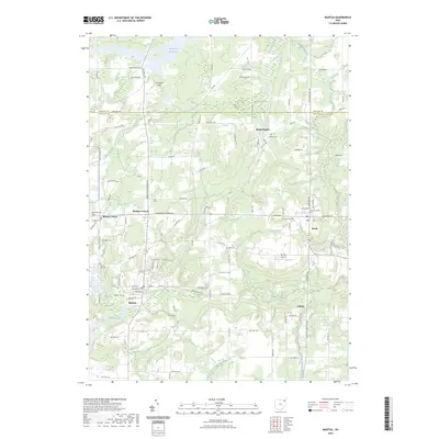
2023 Map of Mantua
USGS Topo · Published 2023About this map
The Cuyahoga River meanders through the heart of this Portage County landscape, defining a region where glacial history and early Ohio settlement patterns intersect. The northern reaches are characterized by the sprawling Mantua Swamp and the headwaters of the West Branch Mahoning River, creating a low-lying hydrological divide. Settlement is concentrated in established hubs like Mantua Center, Mantua Corners, and the village of Mantua, which served as vital local trade centers. To the east, the academic grounds of Hiram College overlook the river valley, standing as a primary cultural landmark alongside Hiram Rapids. Genealogists will find a wealth of burial records preserved across the landscape, from Pioneer Trail Cem and Westlawn Cem to the smaller Vaughn Cem near Eagle Creek.
Find a feature on this map
101 named features on this map. Tap any name to fly to it.
Don’t see what you’re looking for? This feature index may not catch every label — zoom into the map to look around manually.
Map Details
Editions of this 2023 Mantua Map
This is the sole edition of this map. No revisions or reprints were ever made.
Other maps of this area

1905 · Garrettsville
USGS Topo · 1:62,500

1906 · Kent
USGS Topo · 1:62,500

1906 · Chagrin Falls
USGS Topo · 1:62,500

1906 · Ravenna
USGS Topo · 1:62,500

1907 · Garrettsville
USGS Topo · 1:62,500

1908 · Chagrin Falls
USGS Topo · 1:62,500

1908 · Ravenna
USGS Topo · 1:62,500

1950 · Cleveland
USGS Topo · 1:250,000

1953 · South Russell
USGS Topo · 1:24,000

1953 · Aurora
USGS Topo · 1:24,000