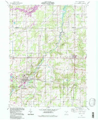
1994 Map of Mantua
USGS Topo · Published 1997About this map
The Upper Cuyahoga State Scenic River defines the landscape of this portion of Portage and Geauga counties, winding through a corridor of Marsh Wetlands and natural preserves. The educational and social heart of the region is centered at Hiram College, while the surrounding rural townships of Mantua and Hiram maintain a network of historic crossroads such as Mantua Center and Mantua Corners.
Find a feature on this map
53 named features on this map. Tap any name to fly to it.
Don’t see what you’re looking for? This feature index may not catch every label — zoom into the map to look around manually.
Map Details
Editions of this 1994 Mantua Map
This is the sole edition of this map. No revisions or reprints were ever made.
Other maps of this area

1905 · Garrettsville
USGS Topo · 1:62,500

1906 · Kent
USGS Topo · 1:62,500

1906 · Chagrin Falls
USGS Topo · 1:62,500

1906 · Ravenna
USGS Topo · 1:62,500

1907 · Garrettsville
USGS Topo · 1:62,500

1908 · Chagrin Falls
USGS Topo · 1:62,500

1908 · Ravenna
USGS Topo · 1:62,500

1950 · Cleveland
USGS Topo · 1:250,000

1953 · South Russell
USGS Topo · 1:24,000

1953 · Aurora
USGS Topo · 1:24,000