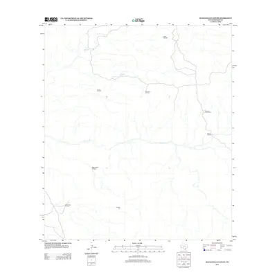
2012 Map of Manzanillo Canyon
USGS Topo · Published 2012About this map
Manzanillo Canyon defines the drainage and topography of this high-desert region in Presidio County, where survival has long depended on discrete water sources. The map details a network of ranching infrastructure, primarily centered on seasonal water and wind power. Significant landmarks such as Manzanillo Spring and Alamo Seco Spring provide the lifeblood for this arid landscape, while the distribution of sites like Rancho Viejo Windmill and Agujitas Windmill indicates the historical footprint of cattle ranching. The presence of Papalote Alto and Papalote de la Señora reflects the local heritage and naming conventions of the Trans-Pecos frontier, showing how thin ribbons of track and creek beds like Terneros Cr connect isolated outposts across the high ground of Cerro Venado.
Find a feature on this map
11 named features on this map. Tap any name to fly to it.
Don’t see what you’re looking for? This feature index may not catch every label — zoom into the map to look around manually.
Map Details
Editions of this 2012 Manzanillo Canyon Map
This is the sole edition of this map. No revisions or reprints were ever made.
Other maps of this area

1896 · Polvo
USGS Topo · 1:125,000

1896 · Shafter
USGS Topo · 1:125,000

1903 · Terlingua
USGS Topo · 1:125,000

1904 · Terlingua
USGS Topo · 1:125,000

1917 · Tascotal Mesa
USGS Topo · 1:62,500

1931 · Lajitas
USGS Topo · 1:62,500

1944 · Tascotal Mesa
USGS Topo · 1:62,500

1959 · Emory Peak
USGS Topo · 1:250,000

1959 · Presidio
USGS Topo · 1:250,000

1965 · Presidio
USGS Topo · 1:250,000