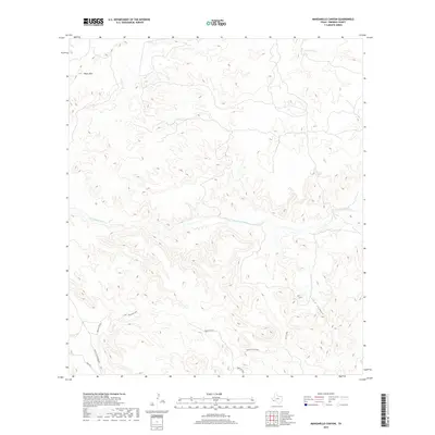
2019 Map of Manzanillo Canyon
USGS Topo · Published 2019About this map
Terneros Creek cuts an ephemeral path across this high-desert landscape in Presidio County, defining the drainage patterns between prominent elevations like the Black Hills to the northwest and the tiered plateaus of Papalote Alto. The terrain is deeply incised by steep-walled features such as Lava Canyon and Cueva Larga, reflecting the volcanic and erosional history of the Trans-Pecos region. Navigation across this remote reach of West Texas is dictated by localized paths like Rancho Viejo and the Stone Corral Bypass, which connect to the larger Main Rd. These roads often follow the natural contours and ridges, such as the Papalote Alto Spur, providing essential access to isolated ranching outposts and land holdings in a region where water sources and topographic barriers shape human movement and settlement.
Find a feature on this map
9 named features on this map. Tap any name to fly to it.
Don’t see what you’re looking for? This feature index may not catch every label — zoom into the map to look around manually.
Map Details
Editions of this 2019 Manzanillo Canyon Map
This is the sole edition of this map. No revisions or reprints were ever made.
Other maps of this area

1896 · Polvo
USGS Topo · 1:125,000

1896 · Shafter
USGS Topo · 1:125,000

1903 · Terlingua
USGS Topo · 1:125,000

1904 · Terlingua
USGS Topo · 1:125,000

1917 · Tascotal Mesa
USGS Topo · 1:62,500

1931 · Lajitas
USGS Topo · 1:62,500

1944 · Tascotal Mesa
USGS Topo · 1:62,500

1959 · Emory Peak
USGS Topo · 1:250,000

1959 · Presidio
USGS Topo · 1:250,000

1965 · Presidio
USGS Topo · 1:250,000