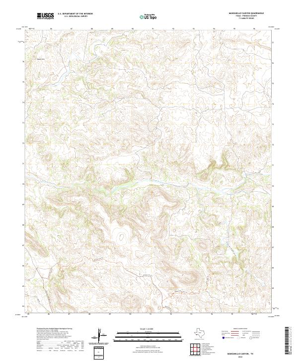
2022 Map of Manzanillo Canyon
USGS Topo · Published 2022About this map
Terneros Creek winds through this arid expanse of Presidio County, defining the drainage patterns of a landscape marked by complex elevations. The terrain is characterized by geological formations such as the Black Hills in the northwest and the deep incision of Lava Canyon to the east. Modern movement through this territory relies on a network of named trails and primitive routes that likely follow long-established paths through the desert. These include the Rancho Viejo Trl and the Stone Coral Bypass Trl, while the Papalote Alto Trl and its associated Papalote Alto Spur Trl traverse the southern ridges. The presence of the Main Rd and the Cueva Larga Trl suggests a region where access is governed by the natural contours of the high desert and historical land use.
Find a feature on this map
10 named features on this map. Tap any name to fly to it.
Don’t see what you’re looking for? This feature index may not catch every label — zoom into the map to look around manually.
Map Details
Editions of this 2022 Manzanillo Canyon Map
This is the sole edition of this map. No revisions or reprints were ever made.
Other maps of this area

1896 · Polvo
USGS Topo · 1:125,000

1896 · Shafter
USGS Topo · 1:125,000

1903 · Terlingua
USGS Topo · 1:125,000

1904 · Terlingua
USGS Topo · 1:125,000

1917 · Tascotal Mesa
USGS Topo · 1:62,500

1931 · Lajitas
USGS Topo · 1:62,500

1944 · Tascotal Mesa
USGS Topo · 1:62,500

1959 · Emory Peak
USGS Topo · 1:250,000

1959 · Presidio
USGS Topo · 1:250,000

1965 · Presidio
USGS Topo · 1:250,000