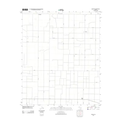
2012 Map of Maple
USGS Topo · Published 2012About this map
Goodland and the surrounding agricultural landscape define this portion of the Texas Panhandle during the early 21st century. The map reveals a highly structured environment organized by a rigid grid of section roads, including Co Rd-42 and Co Rd-1316, reflecting the systematic land division characteristic of the Llano Estacado. The small community of Maple serves as a local hub along Fm-596, while the settlement of Neely Ward appears in the southern reaches of the quadrangle. This 2012 survey illustrates the enduring reliance on an extensive network of rural routes, such as Ranch Road 54, to connect isolated farmsteads and agricultural operations across the wide, level terrain of Bailey County.
Find a feature on this map
29 named features on this map. Tap any name to fly to it.
Don’t see what you’re looking for? This feature index may not catch every label — zoom into the map to look around manually.
Map Details
Editions of this 2012 Maple Map
This is the sole edition of this map. No revisions or reprints were ever made.
Other maps of this area

1954 · Brownfield
USGS Topo · 1:250,000

1958 · Brownfield
USGS Topo · 1:250,000

1962 · Brownfield
USGS Topo · 1:250,000

1968 · Three Way School
USGS Topo · 1:24,000
1968 · Upper White Lake
USGS Topo · 1:24,000

1969 · Maple
USGS Topo · 1:24,000

1969 · Enochs
USGS Topo · 1:24,000

1970 · Lingo
USGS Topo · 1:24,000

1970 · Causey East
USGS Topo · 1:24,000

1970 · Morton NW
USGS Topo · 1:24,000