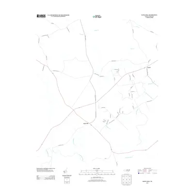
2013 Map of Maple Hill
USGS Topo · Published 2013About this map
Angola and Maple Hill anchor this coastal plain landscape in Pender County, where the terrain is defined by a dense network of slow-moving blackwater streams and vast wetlands. The hydrology is dominated by Sandy Run Swamp and Little Sandy Run Swamp in the southeast, while drainage to the north and west is managed by Angola Cr, Tenmile Cr, and the winding Moores Cr. This 2013 survey illustrates a modern rural infrastructure laid over much older land divisions, visible in long-established routes like Sholar Mill Rd and Lightwood Bridge Rd. The area maintains its agricultural and timber character, with scattered residential clusters such as Newport, Holyfield, and Dehavilland situated near a local Landing Fld. The prominence of Holly Shelter Cr suggests the proximity of significant protected game lands and wetlands that have historically shaped settlement patterns in this part of North Carolina.
Find a feature on this map
51 named features on this map. Tap any name to fly to it.
Don’t see what you’re looking for? This feature index may not catch every label — zoom into the map to look around manually.
Map Details
Editions of this 2013 Maple Hill Map
This is the sole edition of this map. No revisions or reprints were ever made.
Other maps of this area

1942 · Burgaw
USGS Topo · 1:62,500

1943 · Kenansville
USGS Topo · 1:62,500

1948 · Kenansville
USGS Topo · 1:62,500

1948 · Maple Hill
USGS Topo · 1:62,500

1948 · Richlands
USGS Topo · 1:62,500

1953 · Beaufort
USGS Topo · 1:250,000

1954 · Beaufort
USGS Topo · 1:250,000

1965 · Richlands
USGS Topo · 1:62,500

1972 · Beaufort
USGS Topo · 1:250,000
1980 · Richlands
USGS Topo · 1:62,500