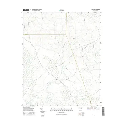
2016 Map of Maple Hill
USGS Topo · Published 2016About this map
The settlement of Maple Hill serves as a central point in this landscape where three counties — Onslow, Pender, and Duplin — converge. Defined by its complex hydrological network, the area is dominated by the expansive Angola Swamp to the west and Sandy Run Swamp to the south. These wetland systems are fed by numerous watercourses including Holly Shelter Creek and Moores Creek, creating a terrain characterized more by its water drainage patterns than by dense urban development.
Find a feature on this map
45 named features on this map. Tap any name to fly to it.
Don’t see what you’re looking for? This feature index may not catch every label — zoom into the map to look around manually.
Map Details
Editions of this 2016 Maple Hill Map
This is the sole edition of this map. No revisions or reprints were ever made.
Other maps of this area

1942 · Burgaw
USGS Topo · 1:62,500

1943 · Kenansville
USGS Topo · 1:62,500

1948 · Kenansville
USGS Topo · 1:62,500

1948 · Maple Hill
USGS Topo · 1:62,500

1948 · Richlands
USGS Topo · 1:62,500

1953 · Beaufort
USGS Topo · 1:250,000

1954 · Beaufort
USGS Topo · 1:250,000

1965 · Richlands
USGS Topo · 1:62,500

1972 · Beaufort
USGS Topo · 1:250,000
1980 · Richlands
USGS Topo · 1:62,500