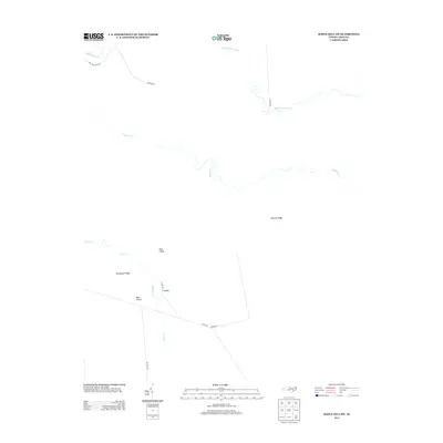
2013 Map of Maple Hill SW
USGS Topo · Published 2013About this map
Holly Shelter Cr and Sandy Run Swamp anchor the complex network of wetlands and low ridges that define this portion of Onslow County. The landscape is characterized by its numerous watercourses, including Shaken Cr and Shelter Swamp Cr, which meander through a region where distinct landforms like Bryants Ridge and Southwest Ridge emerge from the surrounding swamp. The road network is primarily composed of rural connectors such as Old Maple Hill Rd and Godwin Rd, which navigate the edges of these waterways. Farther south, the presence of Pine Island, Back Island, and T Island near Ashes Cr suggests a terrain of isolated rises within the hydrologically sensitive environment. The inclusion of Military Rd reflects the specialized land use patterns often found in this section of coastal North Carolina, providing a record of the infrastructure supporting regional transit and land management.
Find a feature on this map
17 named features on this map. Tap any name to fly to it.
Don’t see what you’re looking for? This feature index may not catch every label — zoom into the map to look around manually.
Map Details
Editions of this 2013 Maple Hill SW Map
This is the sole edition of this map. No revisions or reprints were ever made.
Other maps of this area

1942 · Topsail
USGS Topo · 1:62,500

1942 · Burgaw
USGS Topo · 1:62,500

1947 · Rocky Point
USGS Topo · 1:62,500

1948 · Maple Hill
USGS Topo · 1:62,500

1948 · Topsail
USGS Topo · 1:62,500

1953 · Beaufort
USGS Topo · 1:250,000

1954 · Beaufort
USGS Topo · 1:250,000

1970 · Topsail
USGS Topo · 1:24,000
1970 · Holly Ridge
USGS Topo · 1:24,000
1970 · Mooretown
USGS Topo · 1:24,000