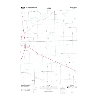
2013 Map of Maples
USGS Topo · Published 2013About this map
The Maumee River and the historic path of the Wabash and Erie Canal dominate the northern landscape of this Allen County region, illustrating the early importance of water transport to the area's development. This 2013 survey shows a sophisticated network of drainage infrastructure, such as the Henry Bandelier Ditch and Popitz Ditch, which support the expansive agricultural lands surrounding small crossroads communities. Small settlements like Maples and Tillman are documented along the southern rail and road corridors, while Zulu sits further east along the historic Lincoln Hwy E. The presence of the Casad Industrial Park Airport north of the highway highlights the transition toward industrial land use near New Haven. Local family names are preserved through numerous drainage and road labels, including Meier Ditch and Nahrwold Ditch, providing valuable clues for researchers tracing the agrarian history of these Hoosier townships.
Find a feature on this map
97 named features on this map. Tap any name to fly to it.
Don’t see what you’re looking for? This feature index may not catch every label — zoom into the map to look around manually.
Map Details
Editions of this 2013 Maples Map
This is the sole edition of this map. No revisions or reprints were ever made.
Other maps of this area

1953 · Fort Wayne
USGS Topo · 1:250,000

1953 · Muncie
USGS Topo · 1:250,000

1956 · Muncie
USGS Topo · 1:250,000

1956 · Fort Wayne
USGS Topo · 1:250,000

1956 · Fort Wayne East
USGS Topo · 1:24,000

1956 · Cedarville
USGS Topo · 1:24,000

1957 · Maples
USGS Topo · 1:24,000

1958 · Grabill
USGS Topo · 1:24,000

1958 · Woodburn North
USGS Topo · 1:24,000

1958 · Woodburn South
USGS Topo · 1:24,000