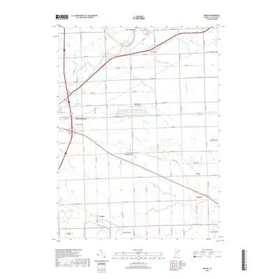
2019 Map of Maples
USGS Topo · Published 2019About this map
New Haven anchors the northwestern corner of this eastern Indiana landscape, where the Maumee River winds through a dense network of agricultural drainage systems. The survey reveals a region defined by its managed water, including Lomont Ditch, Popitz Ditch, and Rushart Ditch, which support the fertile farmstead plots typical of Allen County. Small rural hubs such as Maples, Zulu, and Tillman are interconnected by a rigid grid of country roads, while the presence of Emanuel Cem and family-named waterways like Yoquelet Ditch provide valuable points of reference for genealogists tracking local heritage. An interesting shift in land use is visible at the Casad Industrial Park Airport, contrasting with the more recreational Heritage Snowmobile Trail that cuts through the southern fields. The area's aviation history is further represented by Valhalla Airport near the southwestern corner, reflecting the integration of private airfields into the traditional agrarian environment.
Find a feature on this map
65 named features on this map. Tap any name to fly to it.
Don’t see what you’re looking for? This feature index may not catch every label — zoom into the map to look around manually.
Map Details
Editions of this 2019 Maples Map
This is the sole edition of this map. No revisions or reprints were ever made.
Other maps of this area

1953 · Fort Wayne
USGS Topo · 1:250,000

1953 · Muncie
USGS Topo · 1:250,000

1956 · Muncie
USGS Topo · 1:250,000

1956 · Fort Wayne
USGS Topo · 1:250,000

1956 · Fort Wayne East
USGS Topo · 1:24,000

1956 · Cedarville
USGS Topo · 1:24,000

1957 · Maples
USGS Topo · 1:24,000

1958 · Grabill
USGS Topo · 1:24,000

1958 · Woodburn North
USGS Topo · 1:24,000

1958 · Woodburn South
USGS Topo · 1:24,000