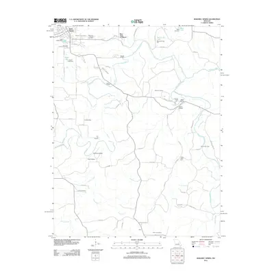
2012 Map of Maramec Spring
USGS Topo · Published 2012About this map
Maramec Spring and the Old Iron Furnace anchor this section of the Ozark Highlands, where industrial history meets a complex network of waterways. The landscape is defined by the winding course of Dry Fork and its many tributaries, including Luther Branch and Norman Creek, which eventually reach the Meramec River to the east. The town of Saint James sits at the northwestern edge, serving as a hub for the surrounding rural area. Local family history and genealogy are well-represented by several burial grounds such as Maramec Cemetery, Hawkins Cemetery, and Adams Cemetery. Notable land features like the Natural Bridge near Boys Town of Missouri and the Asher Lookout Tower in the south reflect a landscape utilized for both institutional residence and forest management.
Find a feature on this map
71 named features on this map. Tap any name to fly to it.
Don’t see what you’re looking for? This feature index may not catch every label — zoom into the map to look around manually.
Map Details
Editions of this 2012 Maramec Spring Map
This is the sole edition of this map. No revisions or reprints were ever made.
Other maps of this area

1903 · Sullivan
USGS Topo · 1:125,000

1928 · Meramec Spring
USGS Topo · 1:62,500

1932 · Steelville
USGS Topo · 1:48,000

1933 · Steelville
USGS Topo · 1:62,500

1934 · Redbird
USGS Topo · 1:62,500

1937 · Steelville
USGS Topo · 1:62,500

1938 · Redbird
USGS Topo · 1:62,500

1948 · Cuba
USGS Topo · 1:24,000

1949 · Saint Louis
USGS Topo · 1:250,000

1949 · Rolla
USGS Topo · 1:250,000