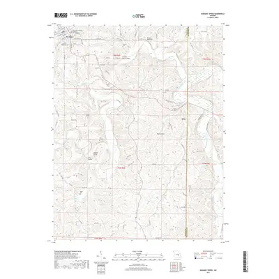
2017 Map of Maramec Spring
USGS Topo · Published 2017About this map
Maramec Spring and its surrounding Ozark highlands define this landscape, where the cold waters of one of the state's largest springs emerge near the Meramec River. The town of St. James serves as a primary hub in the northwest corner, anchored by the Immaculate Conception (Catholic) church and the Saint James Cem Corporation. The area's complex geology is evidenced by several natural landmarks, including the St James Natural Bridge and Pinnacles Bluff Arch along Dry Fork.
Find a feature on this map
80 named features on this map. Tap any name to fly to it.
Don’t see what you’re looking for? This feature index may not catch every label — zoom into the map to look around manually.
Map Details
Editions of this 2017 Maramec Spring Map
This is the sole edition of this map. No revisions or reprints were ever made.
Other maps of this area

1903 · Sullivan
USGS Topo · 1:125,000

1928 · Meramec Spring
USGS Topo · 1:62,500

1932 · Steelville
USGS Topo · 1:48,000

1933 · Steelville
USGS Topo · 1:62,500

1934 · Redbird
USGS Topo · 1:62,500

1937 · Steelville
USGS Topo · 1:62,500

1938 · Redbird
USGS Topo · 1:62,500

1948 · Cuba
USGS Topo · 1:24,000

1949 · Saint Louis
USGS Topo · 1:250,000

1949 · Rolla
USGS Topo · 1:250,000