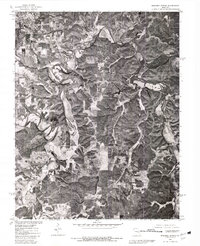
1980 Map of Maramec Spring
USGS Topo · Published 1981About this map
St James occupies the northwestern corner of this 1980 orthophotoquad, showing the transition from a structured town grid to the winding corridors of the Ozark foothills. The landscape is defined by the sharp contrasts between the wooded uplands and the cleared alluvial plains of Dry Fork and the Meramec River. These watercourses carve deep, wandering paths through the terrain, creating a patchwork of agricultural clearings that follow the fertile bottomlands.
Find a feature on this map
6 named features on this map. Tap any name to fly to it.
Don’t see what you’re looking for? This feature index may not catch every label — zoom into the map to look around manually.
Map Details
Editions of this 1980 Maramec Spring Map
This is the sole edition of this map. No revisions or reprints were ever made.
Other maps of this area

1903 · Sullivan
USGS Topo · 1:125,000

1928 · Meramec Spring
USGS Topo · 1:62,500

1932 · Steelville
USGS Topo · 1:48,000

1933 · Steelville
USGS Topo · 1:62,500

1934 · Redbird
USGS Topo · 1:62,500

1937 · Steelville
USGS Topo · 1:62,500

1938 · Redbird
USGS Topo · 1:62,500

1948 · Cuba
USGS Topo · 1:24,000

1949 · Saint Louis
USGS Topo · 1:250,000

1949 · Rolla
USGS Topo · 1:250,000