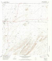
1983 Map of Marathon
USGS Topo · Published 1984About this map
Marathon serves as the focal point for this West Texas landscape, positioned along the Southern Pacific railroad line. The settlement features essential community infrastructure such as a High Sch, a Cemetery, and a Landing Strip, while the surrounding terrain is defined by the Hollow Mountains and its branching drainages like Wood Hollow and Big Wood Hollow. The vast ranching heritage of Brewster County is evident through an extensive network of named water sources, including Coon Windmill, Wegner Windmill, and New Causey Windmill. These scattered landmarks, along with the Post Road and Beakley Draw, reveal the vital infrastructure required for life and industry in the Trans-Pecos region during the early 1980s.
Find a feature on this map
40 named features on this map. Tap any name to fly to it.
Don’t see what you’re looking for? This feature index may not catch every label — zoom into the map to look around manually.
Map Details
Editions of this 1983 Marathon Map
2 editions found
Other maps of this area

1920 · Monument Spring
USGS Topo · 1:62,500

1920 · Marathon
USGS Topo · 1:62,500

1921 · Monument Spring
USGS Topo · 1:62,500

1921 · Marathon
USGS Topo · 1:62,500

1923 · Hess Canyon
USGS Topo · 1:62,500

1923 · Altuda
USGS Topo · 1:62,500

1954 · Fort Stockton
USGS Topo · 1:250,000

1958 · Fort Stockton
USGS Topo · 1:250,000
1967 · Horse Mountain
USGS Topo · 1:24,000

1973 · Fort Stockton
USGS Topo · 1:250,000