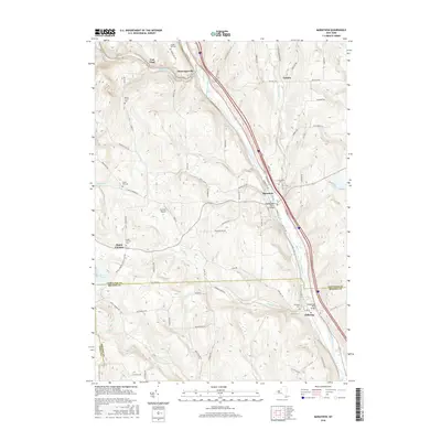
2016 Map of Marathon
USGS Topo · Published 2016About this map
The Tioughnioga River corridor serves as the primary axis for transportation and settlement in this portion of Central New York, where the river valley cuts between high ridges. The village of Marathon occupies a central position along the banks, connected to the southern hamlet of Killawog by both rail and road. The terrain is defined by significant elevations such as Piety Ridge and Steve Russell Hill, which forced early developments and agricultural clearings into the narrow valleys or atop flatter summits.
Find a feature on this map
83 named features on this map. Tap any name to fly to it.
Don’t see what you’re looking for? This feature index may not catch every label — zoom into the map to look around manually.
Map Details
Editions of this 2016 Marathon Map
This is the sole edition of this map. No revisions or reprints were ever made.
Other maps of this area

1903 · Cortland
USGS Topo · 1:62,500

1903 · Harford
USGS Topo · 1:62,500

1904 · Greene
USGS Topo · 1:62,500

1904 · Pitcher
USGS Topo · 1:62,500

1906 · Catatonk
USGS Topo · 1:125,000

1943 · Cincinnatus
USGS Topo · 1:24,000

1944 · Cortland
USGS Topo · 1:31,680
1944 · Mc Graw
USGS Topo · 1:31,680
1944 · Cincinnatus
USGS Topo · 1:31,680

1948 · Binghamton
USGS Topo · 1:250,000