1933 Map of Marble Hill
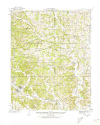
USGS Topo · Published 1973About this map
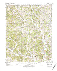
Marble Hill and nearby Lutesville anchor this 1933 survey of the hilly landscape spanning the Bollinger and Cape Girardeau County line. The area's social fabric is remarkably detailed through an extensive network of country schools and churches, including Old Salem School, Thornburgh School, and Brooks Chapel. These small centers of community are distributed along the winding courses of the Whitewater River and Crooked Creek, which shaped the early settlement patterns of the region.
Find a feature on this map
75 named features on this map. Tap any name to fly to it.
Don’t see what you’re looking for? This feature index may not catch every label — zoom into the map to look around manually.
Map Details
Editions of this 1933 Marble Hill Map
3 editions found
Other maps of this area

1910 · Higdon
USGS Topo · 1:62,500

1918 · Altenburg
USGS Topo · 1:62,500

1922 · Cape Girardeau
USGS Topo · 1:62,500

1923 · Perryville
USGS Topo · 1:62,500

1924 · Cape Girardeau
USGS Topo · 1:62,500

1924 · Perryville
USGS Topo · 1:62,500
1925 · Altenburg
USGS Topo · 1:62,500

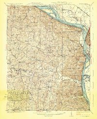
1933 · Marble Hill
USGS Topo · 1:62,500

1933 · Marquand
USGS Topo · 1:62,500

1934 · Morley
USGS Topo · 1:62,500