
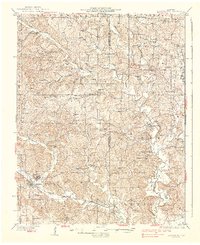
1937 Map of Marble Hill
USGS Topo · Published 1937About this map
The dual settlements of Marble Hill and Lutesville anchor the southwest corner of this Ozark plateau landscape, where the Missouri Pacific railroad cuts through the terrain near Crooked Creek. The 1930s rural economy is evident in the dense network of one-room schools such as Hamestring Sch and Cedar Branch Sch, as well as family-named landmarks like Pulliam Cem and Hartle Cem.
Find a feature on this map
70 named features on this map. Tap any name to fly to it.
Don’t see what you’re looking for? This feature index may not catch every label — zoom into the map to look around manually.
Map Details
Editions of this 1937 Marble Hill Map
2 editions found
Other maps of this area

1910 · Higdon
USGS Topo · 1:62,500

1918 · Altenburg
USGS Topo · 1:62,500

1922 · Cape Girardeau
USGS Topo · 1:62,500

1923 · Perryville
USGS Topo · 1:62,500

1924 · Cape Girardeau
USGS Topo · 1:62,500

1924 · Perryville
USGS Topo · 1:62,500

1925 · Altenburg
USGS Topo · 1:62,500

1933 · Marble Hill
USGS Topo · 1:62,500

1933 · Marquand
USGS Topo · 1:62,500

1934 · Morley
USGS Topo · 1:62,500