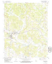
1980 Map of Marble Hill
USGS Topo · Published 1986About this map
Marble Hill and the adjacent community of Lutesville serve as the central hubs for this region of Missouri during the mid-1970s. The landscape is defined by the winding course of Crooked Creek and its many tributaries, such as Hurricane Creek and Hog Creek. The map documents a predominantly rural and religious social fabric, evidenced by the high density of family and community burial grounds including Barks Cem, Shell Cem, and Perkins Cem.
Find a feature on this map
53 named features on this map. Tap any name to fly to it.
Don’t see what you’re looking for? This feature index may not catch every label — zoom into the map to look around manually.
Map Details
Editions of this 1980 Marble Hill Map
2 editions found
Other maps of this area

1933 · Marble Hill
USGS Topo · 1:62,500

1933 · Marquand
USGS Topo · 1:62,500

1934 · Advance
USGS Topo · 1:62,500

1935 · Zalma
USGS Topo · 1:62,500

1937 · Marble Hill
USGS Topo · 1:62,500

1938 · Marquand
USGS Topo · 1:62,500

1939 · Advance
USGS Topo · 1:62,500

1939 · Zalma
USGS Topo · 1:62,500

1949 · Paducah
USGS Topo · 1:250,000

1949 · Rolla
USGS Topo · 1:250,000