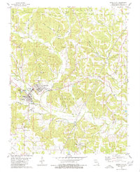
1980 Map of Marble Hill
USGS Topo · Published 1980About this map
Marble Hill and Lutesville serve as the primary hubs of this Bollinger County landscape, situated where the terrain transitions toward Turkey Ridge. The map documents a rural infrastructure defined by narrow creek valleys and ridges, with family legacies preserved at sites like Crossroads Cem and Eaker Cem. An Old Railroad Grade tracks through the southern portion of the survey, marking the former path of the rail-and-river economy that once connected these small settlements. To the west, the Twin City Airfield indicates the late-century modernization of local transport.
Find a feature on this map
50 named features on this map. Tap any name to fly to it.
Don’t see what you’re looking for? This feature index may not catch every label — zoom into the map to look around manually.
Map Details
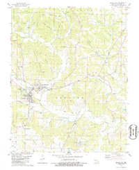
Editions of this 1980 Marble Hill Map
2 editions found
Other maps of this area

1933 · Marble Hill
USGS Topo · 1:62,500

1933 · Marquand
USGS Topo · 1:62,500

1934 · Advance
USGS Topo · 1:62,500

1935 · Zalma
USGS Topo · 1:62,500

1937 · Marble Hill
USGS Topo · 1:62,500

1938 · Marquand
USGS Topo · 1:62,500

1939 · Advance
USGS Topo · 1:62,500

1939 · Zalma
USGS Topo · 1:62,500

1949 · Paducah
USGS Topo · 1:250,000

1949 · Rolla
USGS Topo · 1:250,000