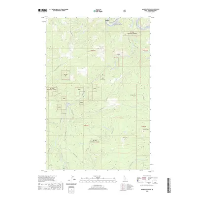
2020 Map of Marble Mountain
USGS Topo · Published 2020About this map
The Saint Joe Wild and Scenic River defines the northern reaches of this Shoshone County landscape, where the historic Old Milwaukee Road RR Grade follows the river's bend near Pocono. This modern survey illustrates the enduring footprint of early 20th-century transportation infrastructure within the Saint Joe National Forest. The terrain is characterized by prominent elevations such as Marble Mtn and Camelback Mtn, with drainage networks including Marble Creek and Daveggio Cr carving through the slopes. Local access is maintained through a network of forest roads and trails, such as the Huckleberry Mtn Rd and Upper Grouse Creek Ohv, which provide passage to interior points like Theriault Lake. The map serves as a detailed record of the intersection between managed federal lands and the legacy of the Milwaukee Road through the Idaho panhandle.
Find a feature on this map
44 named features on this map. Tap any name to fly to it.
Don’t see what you’re looking for? This feature index may not catch every label — zoom into the map to look around manually.
Map Details
Editions of this 2020 Marble Mountain Map
This is the sole edition of this map. No revisions or reprints were ever made.
Other maps of this area

1914 · Avery
USGS Topo · 1:125,000

1917 · Avery
USGS Topo · 1:125,000

1955 · Spokane
USGS Topo · 1:250,000

1956 · Wallace
USGS Topo · 1:250,000

1957 · Wallace
USGS Topo · 1:62,500

1957 · Calder
USGS Topo · 1:62,500

1958 · Spokane
USGS Topo · 1:250,000

1960 · Wallace
USGS Topo · 1:250,000

1969 · Marble Mountain
USGS Topo · 1:24,000

1969 · Grandmother Mtn
USGS Topo · 1:24,000