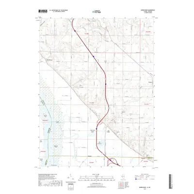
2018 Map of Marblehead
USGS Topo · Published 2018About this map
The Mississippi River bottomlands and the rising bluffs of Adams County define this landscape, where the river's influence is seen in the intricate network of islands and backwaters like Whitney Island, Schaffer Island, and a complex waterway known as The Snuk. This 2018 survey reveals a terrain managed by extensive hydrologic features, notably the Austin Creek Settling Basin and the Fall Creek Settling Basin, designed to mitigate the siltation from the uplands before it reaches the main channel. The settlement pattern follows the geography of the bluff line, with communities like Marblehead, Fall Creek, and Seehorn positioned where the high ground meets the fertile floodplain. For genealogists, the map is particularly rich in family-named landmarks and burial sites, ranging from the Newmaw Family Cem to the Bluff Hall Cem and Thompson Cem, providing precise locations for local heritage research along the river corridor.
Find a feature on this map
110 named features on this map. Tap any name to fly to it.
Don’t see what you’re looking for? This feature index may not catch every label — zoom into the map to look around manually.
Map Details
Editions of this 2018 Marblehead Map
This is the sole edition of this map. No revisions or reprints were ever made.
Other maps of this area

1925 · Quincy
USGS Topo · 1:62,500

1925 · Liberty
USGS Topo · 1:62,500

1927 · Liberty
USGS Topo · 1:62,500

1931 · Barry
USGS Topo · 1:62,500

1932 · Hannibal
USGS Topo · 1:62,500

1936 · Hannibal
USGS Topo · 1:48,000

1936 · Barry
USGS Topo · 1:48,000

1944 · Barry
USGS Topo · 1:62,500

1944 · Quincy
USGS Topo · 1:62,500

1945 · Hannibal
USGS Topo · 1:62,500