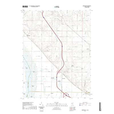
2021 Map of Marblehead
USGS Topo · Published 2021About this map
The Mississippi River forms a dominant boundary along the western edge of this landscape, creating a complex network of islands and waterways such as Whitney Island, Schaffer Island, and the McDonald Chute. Inland, the terrain is defined by the drainage of Austin Cr and Fall Cr, which feed into specialized features like the Austin Creek Settling Basin and Fall Creek Settling Basin. These engineering elements illustrate the management of the floodplains near the settlements of Marblehead, Fall Creek, and Munger.
Find a feature on this map
103 named features on this map. Tap any name to fly to it.
Don’t see what you’re looking for? This feature index may not catch every label — zoom into the map to look around manually.
Map Details
Editions of this 2021 Marblehead Map
This is the sole edition of this map. No revisions or reprints were ever made.
Other maps of this area

1925 · Quincy
USGS Topo · 1:62,500

1925 · Liberty
USGS Topo · 1:62,500

1927 · Liberty
USGS Topo · 1:62,500

1931 · Barry
USGS Topo · 1:62,500

1932 · Hannibal
USGS Topo · 1:62,500

1936 · Hannibal
USGS Topo · 1:48,000

1936 · Barry
USGS Topo · 1:48,000

1944 · Barry
USGS Topo · 1:62,500

1944 · Quincy
USGS Topo · 1:62,500

1945 · Hannibal
USGS Topo · 1:62,500