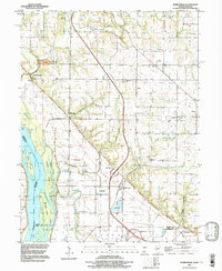
1996 Map of Marblehead
USGS Topo · Published 1998About this map
Mississippi River islands and the rugged bluffs of Adams and Pike Counties define this stretch of the river valley in the late 20th century. The landscape is a complex mix of agricultural bottomlands protected by levees and the high ridges of Melrose and Fall Creek townships. Significant industrial activity is evident at the Quarry near Marblehead, while the lowland areas are managed through a series of drainage features like the Austin Creek Settling Basin and Running Slough.
Find a feature on this map
41 named features on this map. Tap any name to fly to it.
Don’t see what you’re looking for? This feature index may not catch every label — zoom into the map to look around manually.
Map Details
Editions of this 1996 Marblehead Map
This is the sole edition of this map. No revisions or reprints were ever made.
Other maps of this area

1925 · Quincy
USGS Topo · 1:62,500

1925 · Liberty
USGS Topo · 1:62,500

1927 · Liberty
USGS Topo · 1:62,500

1931 · Barry
USGS Topo · 1:62,500

1932 · Hannibal
USGS Topo · 1:62,500

1936 · Hannibal
USGS Topo · 1:48,000

1936 · Barry
USGS Topo · 1:48,000

1944 · Barry
USGS Topo · 1:62,500

1944 · Quincy
USGS Topo · 1:62,500

1945 · Hannibal
USGS Topo · 1:62,500