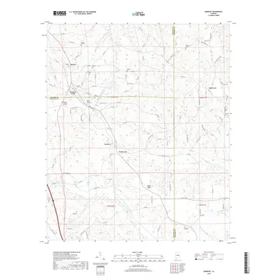
2018 Map of Marbury
USGS Topo · Published 2018About this map
The boundary lines of Autauga, Chilton, and Elmore Counties converge in this rural Alabama landscape, where the settlements of Marbury and Wadsworth sit along the winding course of Shoal Cr. The map reveals a dense network of local county roads and trails that connect small communities such as Midway, Mountain Creek, and Lightwood. This area is characterized by numerous family and community burial grounds, providing a significant resource for genealogical research into the region's inhabitants.
Find a feature on this map
114 named features on this map. Tap any name to fly to it.
Don’t see what you’re looking for? This feature index may not catch every label — zoom into the map to look around manually.
Map Details
Editions of this 2018 Marbury Map
This is the sole edition of this map. No revisions or reprints were ever made.
Other maps of this area

1891 · Clanton
USGS Topo · 1:125,000

1901 · Wetumpka
USGS Topo · 1:125,000

1903 · Wetumpka
USGS Topo · 1:125,000

1953 · Montgomery
USGS Topo · 1:250,000

1956 · Montgomery
USGS Topo · 1:250,000

1957 · Montgomery
USGS Topo · 1:250,000

1959 · Billingsley
USGS Topo · 1:62,500

1959 · Elmore
USGS Topo · 1:62,500

1971 · Richville
USGS Topo · 1:24,000
1971 · Mitchell Dam
USGS Topo · 1:24,000