
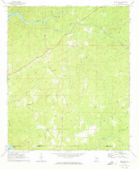
1971 Map of Richville
USGS Topo · Published 1973About this map
Hatchet Creek winds through the northern reaches of this landscape, its path marked by rapids before feeding into Mitchell Lake. This 1971 record of Coosa County shows a rural topography defined by established crossroads and small watercourses like Pinchoulee Creek and Town Creek. Central to the area is Richville, situated near Travelers Rest, serving as a hub for the surrounding countryside.
Find a feature on this map
34 named features on this map. Tap any name to fly to it.
Don’t see what you’re looking for? This feature index may not catch every label — zoom into the map to look around manually.
Map Details
Editions of this 1971 Richville Map
2 editions found
Other maps of this area

1901 · Wetumpka
USGS Topo · 1:125,000

1901 · Wetumpka
USGS Topo · 1:62,500

1903 · Wetumpka
USGS Topo · 1:125,000

1953 · Montgomery
USGS Topo · 1:250,000

1956 · Montgomery
USGS Topo · 1:250,000

1957 · Montgomery
USGS Topo · 1:250,000
1959 · Wetumpka
USGS Topo · 1:62,500

1959 · Elmore
USGS Topo · 1:62,500
1971 · Mitchell Dam NW
USGS Topo · 1:24,000
1971 · Flag Mountain
USGS Topo · 1:24,000