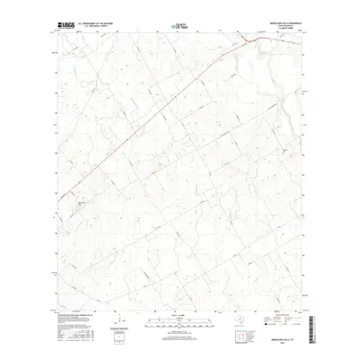
2016 Map of Marcelinas Hills
USGS Topo · Published 2016About this map
Marcelinas Hills rise above the drainage basins of south-central Texas, where the landscape is defined by the winding paths of Marcelinas Cr, Cibolo Cr, and Pajarito Cr. This 2016 survey illustrates a rural corridor in Wilson County where historic transportation routes like the Old Floresville Rd intersect with modern farm-to-market roads. The settlement patterns here are largely dispersed, characterized by family-named landmarks and long-established land divisions. Genealogists and local historians will find the location of the Wheeler Cem particularly valuable, as it sits isolated near the eastern edge of the map, north of Co Rd 312. The road network, featuring names like Dismuke Ln and Standish St, suggests the gradual evolution from early ranch tracks to more structured residential developments near the hills themselves.
Find a feature on this map
37 named features on this map. Tap any name to fly to it.
Don’t see what you’re looking for? This feature index may not catch every label — zoom into the map to look around manually.
Map Details
Editions of this 2016 Marcelinas Hills Map
This is the sole edition of this map. No revisions or reprints were ever made.
Other maps of this area

1920 · Smiley
USGS Topo · 1:125,000

1936 · Floresville
USGS Topo · 1:62,500

1942 · Dewville
USGS Topo · 1:62,500

1953 · Seguin
USGS Topo · 1:250,000

1954 · San Antonio
USGS Topo · 1:250,000

1956 · Dewville
USGS Topo · 1:62,500

1957 · San Antonio
USGS Topo · 1:250,000

1958 · Seguin
USGS Topo · 1:250,000

1958 · La Vernia SW
USGS Topo · 1:24,000

1960 · Kosciusko
USGS Topo · 1:24,000