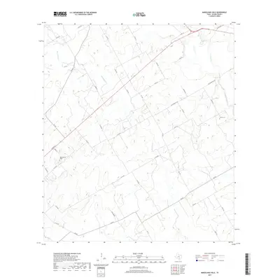
2019 Map of Marcelinas Hills
USGS Topo · Published 2019About this map
Marcelinas Hills occupies a central position in this rural Texas landscape, characterized by the winding drainage of Marcelinas Cr and its tributaries. The topography is defined by the convergence of several major creek systems, including Cibolo Cr to the northeast and Pajarito Cr to the southwest. This area reflects a traditional rural layout where local transit is facilitated by a dense grid of county roads, such as Co RD 305 and Co RD 401, alongside farm-to-market routes like FM 537 and FM 539. For researchers of local family history, the Wheeler Cem serves as a critical grounded landmark amidst the agricultural parcels. The street names, ranging from Arena Ln to the evocative Gentle Breeze, indicate the gradual residential subdivision of former ranchland near the Old Floresville Rd corridor.
Find a feature on this map
36 named features on this map. Tap any name to fly to it.
Don’t see what you’re looking for? This feature index may not catch every label — zoom into the map to look around manually.
Map Details
Editions of this 2019 Marcelinas Hills Map
This is the sole edition of this map. No revisions or reprints were ever made.
Other maps of this area

1920 · Smiley
USGS Topo · 1:125,000

1936 · Floresville
USGS Topo · 1:62,500

1942 · Dewville
USGS Topo · 1:62,500

1953 · Seguin
USGS Topo · 1:250,000

1954 · San Antonio
USGS Topo · 1:250,000

1956 · Dewville
USGS Topo · 1:62,500

1957 · San Antonio
USGS Topo · 1:250,000

1958 · Seguin
USGS Topo · 1:250,000

1958 · La Vernia SW
USGS Topo · 1:24,000

1960 · Kosciusko
USGS Topo · 1:24,000