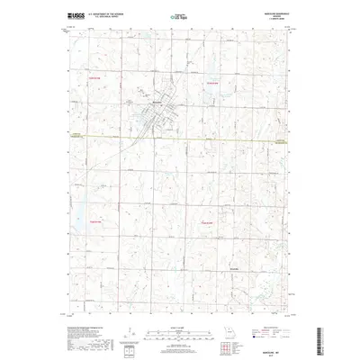
2017 Map of Marceline
USGS Topo · Published 2017About this map
Marceline serves as the central hub of this Missouri landscape, where the grid of city streets transitions into the rolling drainage basins of Linn Co and Chariton Co. The town is well-established, featuring several community focal points including the Saint Bonaventure Cem, Mount Olive Cem, and the Marceline Country Club Lake. Local hydrology is dominated by a network of small creeks and several notable named impoundments like Marceline Old Reservoir and Doctor Charles Martin Lake. To the south, the smaller settlement of Westville sits along Westville RD, surrounded by a rural landscape marked by family-named landmarks and historical burial grounds such as Bell Cem. The area is defined by the headwaters of numerous waterways, including Mussel Fork and Clarks Cr, which carve through the farmland between the northern and southern townships.
Find a feature on this map
66 named features on this map. Tap any name to fly to it.
Don’t see what you’re looking for? This feature index may not catch every label — zoom into the map to look around manually.
Map Details
Editions of this 2017 Marceline Map
This is the sole edition of this map. No revisions or reprints were ever made.
Other maps of this area

1946 · Brookfield
USGS Topo · 1:62,500

1948 · Brookfield
USGS Topo · 1:62,500

1949 · Indian Grove
USGS Topo · 1:24,000

1949 · Rothville
USGS Topo · 1:24,000

1949 · Bucklin
USGS Topo · 1:24,000

1950 · Bucklin
USGS Topo · 1:24,000

1950 · New Cambria West
USGS Topo · 1:24,000

1950 · Rothville
USGS Topo · 1:24,000

1953 · Moberly
USGS Topo · 1:250,000

1953 · Marceline
USGS Topo · 1:24,000