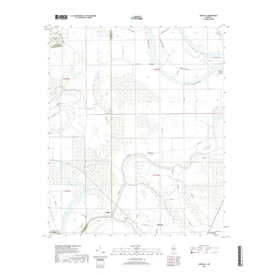
2018 Map of Marcella
USGS Topo · Published 2018About this map
Tchula Lake and Horseshoe Lake dominate this landscape within the Mississippi Delta, following the sinuous paths of former river channels. Small agricultural communities such as Marcella, Choctaw, Butler, and Refuge are distributed across the alluvial plain, connected by a network of local roads like Belmont Rd and Marcella Rd. The area is characterized by significant wetland features, including Snake Creek Brake and Mathena Brake, which indicate the low-lying, often saturated nature of the terrain between the major water bodies. Local history is anchored at the Marcella Cem and the small settlement of Westfield at the southern edge. The presence of Southland Flying Service Inc near Horseshoe Plantation Rd reflects the modern intersection of aviation and industrial-scale agriculture in this fertile region near the border of Holmes, Humphreys, and Leflore Counties.
Find a feature on this map
48 named features on this map. Tap any name to fly to it.
Don’t see what you’re looking for? This feature index may not catch every label — zoom into the map to look around manually.
Map Details
Editions of this 2018 Marcella Map
This is the sole edition of this map. No revisions or reprints were ever made.
Other maps of this area

1940 · Seven Pines
USGS Topo · 1:62,500

1940 · Lexington
USGS Topo · 1:62,500

1940 · Mileston
USGS Topo · 1:62,500

1953 · Greenwood
USGS Topo · 1:250,000

1954 · Mileston
USGS Topo · 1:62,500

1956 · Greenwood
USGS Topo · 1:250,000

1957 · Lexington
USGS Topo · 1:62,500

1957 · Seven Pines
USGS Topo · 1:62,500

1958 · Seven Pines
USGS Topo · 1:62,500

1958 · Lexington
USGS Topo · 1:62,500