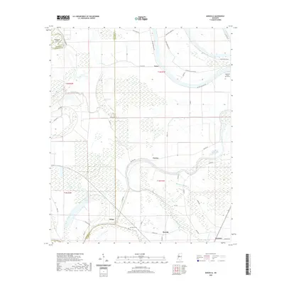
2020 Map of Marcella
USGS Topo · Published 2020About this map
Tchula Lake meanders across this Mississippi Delta landscape, defining the rural character of Holmes and Humphreys counties. Small agricultural settlements like Marcella and Butler are connected by a network of plantation roads and country lanes, including Horseshoe Plantation Rd and Outside Horseshoe Rd, which trace the ancient curves of the river system. The presence of Marcella Cem and the Southland Flying Service Inc air strip near the river bends speaks to the community's long-standing connection to the land and the modernization of local agriculture. The terrain is marked by wetland features such as Snake Creek Brake and Mathena Brake, highlighting the low-lying, water-dependent geography of the region. This survey captures a moment where old waterways like Old Fannegusha Cr and Old Black Cr remain central to the area's identity alongside the newer commercial footprints of the mid-20th century.
Find a feature on this map
48 named features on this map. Tap any name to fly to it.
Don’t see what you’re looking for? This feature index may not catch every label — zoom into the map to look around manually.
Map Details
Editions of this 2020 Marcella Map
This is the sole edition of this map. No revisions or reprints were ever made.
Other maps of this area

1940 · Seven Pines
USGS Topo · 1:62,500

1940 · Lexington
USGS Topo · 1:62,500

1940 · Mileston
USGS Topo · 1:62,500

1953 · Greenwood
USGS Topo · 1:250,000

1954 · Mileston
USGS Topo · 1:62,500

1956 · Greenwood
USGS Topo · 1:250,000

1957 · Lexington
USGS Topo · 1:62,500

1957 · Seven Pines
USGS Topo · 1:62,500

1958 · Seven Pines
USGS Topo · 1:62,500

1958 · Lexington
USGS Topo · 1:62,500