
1973 Map of Marco Island
USGS Topo · Published 1976About this map
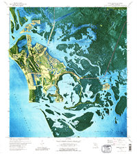
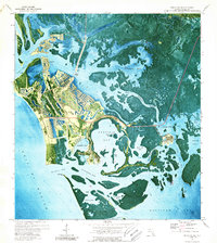
Marco and Goodland anchor this orthophotomap, which documents the rapid transformation of the Collier County coast in the early 1970s. The landscape is defined by the emergence of master-planned canal communities and the dredging of Smokehouse Bay and Collier Bay, contrasting with the wilder expanses of Horrs Island and Kice Island to the south. Local landmarks like St Marks Ch and Barfield Sch sit amidst a growing infrastructure that includes the Marco Island Airport and a Toll Bridge connecting the island to the mainland near Bear Pt.
Find a feature on this map
58 named features on this map. Tap any name to fly to it.
Don’t see what you’re looking for? This feature index may not catch every label — zoom into the map to look around manually.
Map Details
Editions of this 1973 Marco Island Map
3 editions found
Other maps of this area

1956 · Miami
USGS Topo · 1:250,000

1956 · West Palm Beach
USGS Topo · 1:250,000

1957 · West Palm Beach
USGS Topo · 1:250,000

1958 · West Palm Beach
USGS Topo · 1:250,000

1958 · Miami
USGS Topo · 1:250,000

1958 · Belle Meade
USGS Topo · 1:24,000

1958 · Naples South
USGS Topo · 1:24,000

1958 · Belle Meade SE
USGS Topo · 1:24,000

1973 · Cape Romano
USGS Topo · 1:24,000
1973 · Royal Palm Hammock
USGS Topo · 1:24,000