
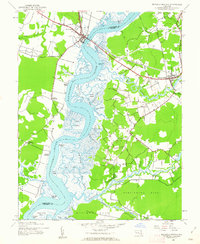
1942 Map of Mardela Springs
USGS Topo · Published 1962About this map
The Nanticoke River defines this Eastern Shore landscape, serving as the boundary between Dorchester and Wicomico counties. Near the head of the river's wider reach, Vienna and Rabbit Town sit at a critical crossing point marked by Ferry Point. The river's intricate network of tidal guts and thorofares, such as Little Thorofare and Rags Thorofare, reveals a complex marshland environment that shaped local transport and settlement patterns.
Find a feature on this map
65 named features on this map. Tap any name to fly to it.
Don’t see what you’re looking for? This feature index may not catch every label — zoom into the map to look around manually.
Map Details
Editions of this 1942 Mardela Springs Map
2 editions found
Other maps of this area

1901 · Salisbury
USGS Topo · 1:62,500

1903 · Nanticoke
USGS Topo · 1:62,500

1905 · Hurlock
USGS Topo · 1:62,500

1915 · Seaford
USGS Topo · 1:62,500

1942 · Wetipquin
USGS Topo · 1:24,000

1942 · Eden
USGS Topo · 1:24,000

1942 · Hebron
USGS Topo · 1:24,000
1942 · Nanticoke
USGS Topo · 1:24,000
1942 · Chicamacomico
USGS Topo · 1:24,000
1943 · Chicamacomico
USGS Topo · 1:31,680