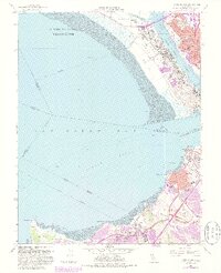
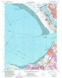
1959 Map of Mare Island
USGS Topo · Published 1985About this map
Mare Island Naval Reservation dominates this mid-century portrait of the San Pablo Bay shoreline, showcasing the intensive military and industrial footprint of the era. The island itself is a complex of radio towers, dry docks, and a naval hospital, separated from the growing city of Vallejo by the Mare Island Strait. To the north, Guadalcanal Village and Island No 1 sit near the salt evaporators of Dutchman Slough, marking the transition to the San Pablo Bay National Wildlife Refuge.
Find a feature on this map
61 named features on this map. Tap any name to fly to it.
Don’t see what you’re looking for? This feature index may not catch every label — zoom into the map to look around manually.
Map Details
Editions of this 1959 Mare Island Map
5 editions found
Other maps of this area

1895 · San Francisco
USGS Topo · 1:62,500

1896 · Carquinez Strait
USGS Topo · 1:62,500

1897 · Concord
USGS Topo · 1:62,500

1898 · Karquines
USGS Topo · 1:62,500

1899 · San Francisco
USGS Topo · 1:62,500

1901 · Karquines
USGS Topo · 1:62,500

1902 · Napa
USGS Topo · 1:125,000

1915 · Concord
USGS Topo · 1:62,500

1915 · San Francisco
USGS Topo · 1:62,500

1916 · Mare Island
USGS Topo · 1:62,500