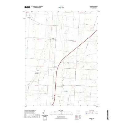
2019 Map of Marengo
USGS Topo · Published 2019About this map
Marengo and the surrounding townships of Morrow County define this central Ohio landscape, where the headwaters of the Scioto River basin carve across the terrain. Small agricultural hamlets like Fulton and South Woodbury anchor a network of rural routes, including the Sunbury State Rd and Waldo-Fulton-Chesterville Rd. The map is particularly rich for genealogical research, documenting numerous small burial grounds such as Asbury Cem, Buck Cem, and the Woodbury Methodist Episcopal Cem. Waterways like Alum Cr and Big Walnut Cr flow southward, dictating the historical placement of early settlements and roads. The presence of North Fargo Cem and Marengo Cem provides precise locations for family historians tracing roots in the Cardington and Bennington Township areas during the early 21st century.
Find a feature on this map
87 named features on this map. Tap any name to fly to it.
Don’t see what you’re looking for? This feature index may not catch every label — zoom into the map to look around manually.
Map Details
Editions of this 2019 Marengo Map
This is the sole edition of this map. No revisions or reprints were ever made.
Other maps of this area

1913 · Mount Gilead
USGS Topo · 1:62,500

1915 · Shauck
USGS Topo · 1:62,500

1915 · Marengo
USGS Topo · 1:62,500

1915 · Fredericktown
USGS Topo · 1:62,500

1916 · Mount Gilead
USGS Topo · 1:62,500

1943 · Shauck
USGS Topo · 1:62,500

1943 · Marengo
USGS Topo · 1:62,500

1943 · Mount Gilead
USGS Topo · 1:62,500

1943 · Fredericktown
USGS Topo · 1:62,500

1950 · Marion
USGS Topo · 1:250,000