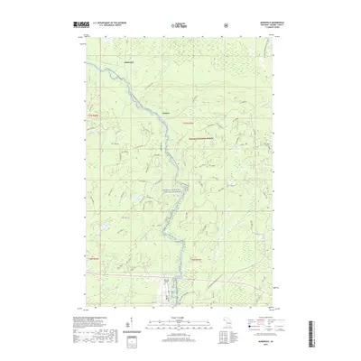
2019 Map of Marenisco
USGS Topo · Published 2019About this map
Presque Isle Wild and Scenic River defines the central corridor of this area, flowing through the heart of the Ottawa National Forest. The landscape is characterized by a dense network of forest roads and historic grades, such as the Ethelwood Grade and Dinky Rd, which trace the legacy of resource extraction in the Upper Peninsula. Named for local industry, Copps Mine Rd hints at the copper and iron mining history common to this part of Gogebic County. The topography is anchored by Wolf Mountain in the west, while water features like Yondota Falls and numerous creeks—including Kinnikinnic Cr and Marenisco Cr—feed into the river system. To the south, the Marenisco Township Cem provides a focal point for genealogical research near the edges of the small settlements of Ethelwood and Theilers.
Find a feature on this map
68 named features on this map. Tap any name to fly to it.
Don’t see what you’re looking for? This feature index may not catch every label — zoom into the map to look around manually.
Map Details
Editions of this 2019 Marenisco Map
This is the sole edition of this map. No revisions or reprints were ever made.
Other maps of this area

1955 · Marenisco
USGS Topo · 1:62,500

1955 · Marenisco
USGS Topo · 1:24,000

1955 · Wakefield
USGS Topo · 1:62,500

1955 · Wakefield NE
USGS Topo · 1:24,000

1956 · Bergland
USGS Topo · 1:62,500

1956 · Thomaston
USGS Topo · 1:62,500

1958 · Iron River
USGS Topo · 1:250,000

1960 · Iron River
USGS Topo · 1:250,000

1961 · Iron River
USGS Topo · 1:250,000

1967 · Iron River
USGS Topo · 1:250,000