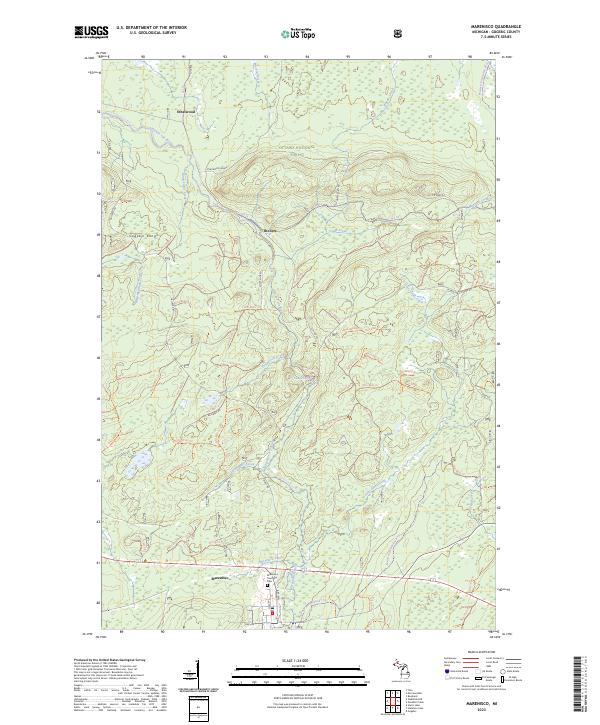
2023 Map of Marenisco
USGS Topo · Published 2023About this map
The Ottawa National Forest provides the backdrop for this study of the northern woods near the Michigan-Wisconsin border. The settlement of Marenisco serves as the primary hub in the south, where the Marenisco Township Cem and local streets like Pine Ave are documented. To the north, smaller locales like Theilers and Ethelwood sit along the winding path of the Presque Isle Wild and Scenic River, which is fed by numerous tributaries including Kinnickinnic Creek and Capps Creek. The landscape is defined by the Gogebic Range and a dense network of forest service trails and former logging routes like the Ethelwood Grade. Water is a dominant feature of this terrain, highlighted by the location of Yondota Falls and the confluence of several namesake streams such as Prospectors Creek and Squatters Creek.
Find a feature on this map
70 named features on this map. Tap any name to fly to it.
Don’t see what you’re looking for? This feature index may not catch every label — zoom into the map to look around manually.
Map Details
Editions of this 2023 Marenisco Map
This is the sole edition of this map. No revisions or reprints were ever made.
Other maps of this area

1955 · Marenisco
USGS Topo · 1:62,500

1955 · Marenisco
USGS Topo · 1:24,000

1955 · Wakefield
USGS Topo · 1:62,500

1955 · Wakefield NE
USGS Topo · 1:24,000

1956 · Bergland
USGS Topo · 1:62,500

1956 · Thomaston
USGS Topo · 1:62,500

1958 · Iron River
USGS Topo · 1:250,000

1960 · Iron River
USGS Topo · 1:250,000

1961 · Iron River
USGS Topo · 1:250,000

1967 · Iron River
USGS Topo · 1:250,000