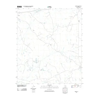
2010 Map of Margie
USGS Topo · Published 2010About this map
Marquez and Flynn anchor the northwest and southeast corners of this rural landscape, which is defined by a dense network of creeks and small impoundments. The terrain is bisected by the historic Old Flynn Rd, a route that connects the scattered homesteads and local roads of central Leon County. Genealogists will find the locations of Green Cemetery and White Cemetery particularly useful for tracing family ties in this agrarian region.
Find a feature on this map
52 named features on this map. Tap any name to fly to it.
Don’t see what you’re looking for? This feature index may not catch every label — zoom into the map to look around manually.
Map Details
Editions of this 2010 Margie Map
This is the sole edition of this map. No revisions or reprints were ever made.
Other maps of this area

1925 · Marquez No. 1
USGS Topo · 1:48,000

1925 · Marquez No. 4
USGS Topo · 1:48,000

1927 · Marquez
USGS Topo · 1:62,500

1930 · Marquez
USGS Topo · 1:62,500

1954 · Waco
USGS Topo · 1:250,000

1955 · Waco
USGS Topo · 1:250,000

1956 · Jewett
USGS Topo · 1:62,500

1964 · Spring Seat
USGS Topo · 1:24,000
1964 · Normangee
USGS Topo · 1:24,000
1964 · Hilltop Lakes
USGS Topo · 1:24,000