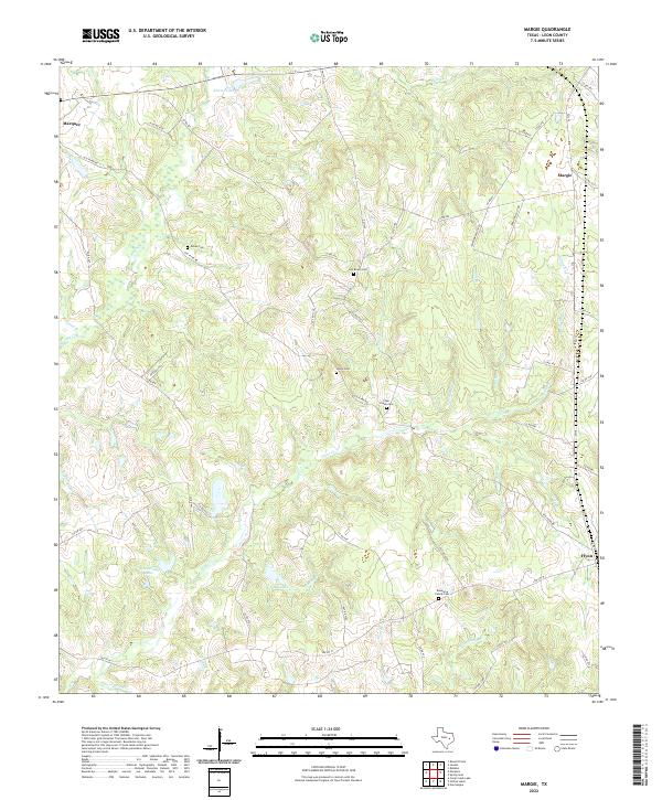
2022 Map of Margie
USGS Topo · Published 2022About this map
The community of Flynn and the rural crossroads of Margie anchor this corner of Leon County, where the landscape is defined by the dense branching of the Clear Cr and Spring Branch drainage systems. This 2022 survey captures a transition between open Texas ranch land and the wooded creek bottoms of the Post Oak Savannah. For genealogists, the map provides precise locations for several local burial grounds, including the Newsome Family Cem and the Old Bowin Cem. Local transport is dominated by the historic route of Old Flynn Rd and the more modern FM 1147, which weave through the rolling topography north of FM 977 W. Several small, named water bodies like Karnei Lake and Grimes Lake sit alongside numerous unlabelled ponds, reflecting the area's agricultural reliance on water management for livestock.
Find a feature on this map
61 named features on this map. Tap any name to fly to it.
Don’t see what you’re looking for? This feature index may not catch every label — zoom into the map to look around manually.
Map Details
Editions of this 2022 Margie Map
This is the sole edition of this map. No revisions or reprints were ever made.
Other maps of this area

1925 · Marquez No. 1
USGS Topo · 1:48,000

1925 · Marquez No. 4
USGS Topo · 1:48,000

1927 · Marquez
USGS Topo · 1:62,500

1930 · Marquez
USGS Topo · 1:62,500

1954 · Waco
USGS Topo · 1:250,000

1955 · Waco
USGS Topo · 1:250,000

1956 · Jewett
USGS Topo · 1:62,500

1964 · Spring Seat
USGS Topo · 1:24,000
1964 · Normangee
USGS Topo · 1:24,000
1964 · Hilltop Lakes
USGS Topo · 1:24,000