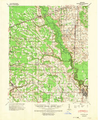
1940 Map of Marianna
USGS Topo · Published 1952About this map
Marianna anchors the lower delta landscape of this survey, situated at a critical bend where the L'Anguille River meets Three Mile Slough. This region of St. Francis and Lee Counties is defined by its drainage and river commerce, specifically noted by the Head of Navigation marker near town. The land is densely dotted with local institutions that speak to a dispersed rural society, including Shiloh Ch, Scruggs Chapel, and Walnut Grove Ch.
Find a feature on this map
52 named features on this map. Tap any name to fly to it.
Don’t see what you’re looking for? This feature index may not catch every label — zoom into the map to look around manually.
Map Details
Editions of this 1940 Marianna Map
2 editions found
Other maps of this area

1939 · Park Place
USGS Topo · 1:62,500

1939 · Wynne
USGS Topo · 1:62,500

1939 · Hunter
USGS Topo · 1:62,500

1939 · Latour
USGS Topo · 1:62,500

1940 · Marvell
USGS Topo · 1:62,500

1940 · Whitmore
USGS Topo · 1:62,500

1940 · Holly Grove
USGS Topo · 1:62,500

1940 · Brinkley
USGS Topo · 1:62,500

1940 · Marianna
USGS Topo · 1:62,500

1948 · Helena
USGS Topo · 1:250,000