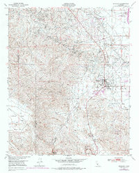
1950 Map of Maricopa
USGS Topo · Published 1976About this map
Oil Wells and industrial infrastructure dominate the terrain around Maricopa at the southern edge of the San Joaquin Valley. This mid-century landscape is defined by the extraction economy of the Midway Valley, featuring the Norwalk Oil Refinery, a Gas Plant, and the extensive tracks of the Sunset Railroad. These industrial sites sit in sharp contrast to the western topography, where the Elkhorn Plain and Beam Flat transition into the sharp descents of Devils Gulch. Significant water infrastructure, including the California Aqueduct and the Bitterwater Spring, highlights the critical role of resource management in this arid environment. The map captures the small settlements of Hazelton and Kerto, along with local landmarks like Capitol Park and several landing strips, providing a clear view of the regional layout before later 20th-century developments altered the footprint of these oil-field communities.
Find a feature on this map
22 named features on this map. Tap any name to fly to it.
Don’t see what you’re looking for? This feature index may not catch every label — zoom into the map to look around manually.
Map Details
Editions of this 1950 Maricopa Map
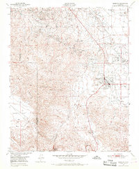
2 editions found
Other maps of this area

1902 · Santa Ynez
USGS Topo · 1:125,000

1903 · Mt. Pinos
USGS Topo · 1:125,000

1905 · Santa Ynez
USGS Topo · 1:125,000

1910 · Buena Vista Lake
USGS Topo · 1:125,000

1912 · McKittrick
USGS Topo · 1:125,000

1912 · Buena Vista Lake
USGS Topo · 1:125,000

1929 · Mouth of Kern
USGS Topo · 1:31,680

1931 · Pentland Junction
USGS Topo · 1:31,680

1932 · Mouth of Kern
USGS Topo · 1:31,680

1934 · Pentland
USGS Topo · 1:31,680